Philip's Maps
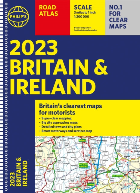
2023 Philip's Road Atlas Britain and Ireland: (A4 Spiral)
2023 Philip's Road Atlas Britain and Ireland: (A4 Spiral)
💎 Earn 64 Points (£0.64) on this item.
YOU SAVE £3.12
- Condition: Brand new
- UK Delivery times: Usually arrives within 2 - 3 working days
- UK Shipping: Fee starts at £2.39. Subject to product weight & dimension
Bulk ordering. Want 15 or more copies? Get a personalised quote and bigger discounts. Learn more about bulk orders.
Couldn't load pickup availability
- More about 2023 Philip's Road Atlas Britain and Ireland: (A4 Spiral)
Philip's 2023 Road Atlas Britain and Ireland is the ultimate spiral-bound road atlas, featuring 160 pages of super-clear road maps, 10 pages of detailed route-planning maps, 88 indexed town-centre maps, 14 pages of city approach maps with named arterial roads, and a 2-page road map of Ireland. It has been voted Britain's clearest and most detailed in an independent consumer survey.
Format: Spiral bound
Length: 256 pages
Publication date: 02 June 2022
Publisher: Octopus Publishing Group
PHILIP S - No. 1 in the UK for clear maps
Good balance between detail and clarity with excellent town maps
What Car?
Mapping at a scale of 3 miles to 1 inch = 1:200,000
Philip s: Market leader and Britain s clearest maps for motorists
Completely updated and revised for 2023
New map showing Smart Motorways - Practical spiral bound, lie-flat format
160 pages of fully updated super-clear road maps
10 pages of detailed route-planning maps
Plan your route in advance
88 indexed town-centre maps
14 pages of city approach maps with named arterial roads
2 page road map of Ireland
Map of scenic Britain and a map highlighting railways, airports and ferry ports
Philip s 2023 Road Atlas Britain and Ireland is the top-of-the-range spiral road atlas featuring the latest maps from the Philip s digital database. Voted Britain s clearest and most detailed in an independent consumer survey, the mapping is super-clear.
Philip s 2023 Road Atlas Britain and Ireland contains 160 pages of road maps covering Britain at 3 miles to 1 inch, with the Western Isles, Orkney and Shetland at smaller scales. The maps clearly mark service areas, roundabouts and multi-level junctions, and in rural areas distinguish between roads over and under 4 metres wide.
The atlas also includes a 2-page road map of Ireland, 10 pages of route-planning maps, a distance table, 10 large-scale city approach maps with named arterial roads, and 88 extra-detailed and fully indexed town and city plans.
Weight: 704g
Dimension: 227 x 299 x 17 (mm)
ISBN-13: 9781849076098
This item can be found in:
UK and International shipping information
UK and International shipping information
UK Delivery and returns information:
- Delivery within 2 - 3 days when ordering in the UK.
- Shipping fee for UK customers from £2.39. Fully tracked shipping service available.
- Returns policy: Return within 30 days of receipt for full refund.
International deliveries:
Shulph Ink now ships to Australia, Belgium, Canada, France, Germany, Ireland, Italy, India, Luxembourg Saudi Arabia, Singapore, Spain, Netherlands, New Zealand, United Arab Emirates, United States of America.
- Delivery times: within 5 - 10 days for international orders.
- Shipping fee: charges vary for overseas orders. Only tracked services are available for most international orders. Some countries have untracked shipping options.
- Customs charges: If ordering to addresses outside the United Kingdom, you may or may not incur additional customs and duties fees during local delivery.