A-Z maps
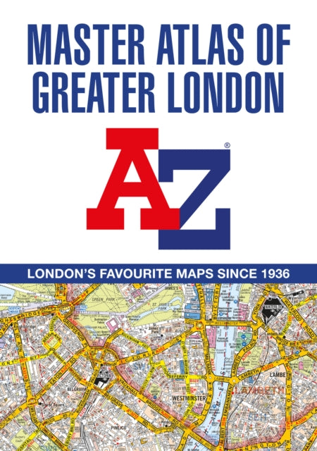
A -Z Master Atlas of Greater London
A -Z Master Atlas of Greater London
💎 Earn 74 Points (£0.74) on this item.
YOU SAVE £6.01
- Condition: Brand new
- UK Delivery times: Usually arrives within 2 - 3 working days
- UK Shipping: Fee starts at £2.39. Subject to product weight & dimension
Bulk ordering. Want 15 or more copies? Get a personalised quote and bigger discounts. Learn more about bulk orders.
Couldn't load pickup availability
- More about A -Z Master Atlas of Greater London
A comprehensive paperback street atlas of London with coloured street mapping, covering an area of 1,450 square miles and including more than 90,000 streets and other addresses. It extends beyond the Greater London and M25 area to various locations in Hemel Hempstead, St. Albans, Potters Bar, Waltham Cross, Epping, Brentwood, Thurrock, Stanford-le-Hope, Gravesend, Wrotham, Sevenoaks, Westerham, Oxted, Redhill, Reigate, Leatherhead, Great Bookham, Woking, Egham, Windsor, Slough, Chalfont St. Peter, Chorleywood, and Bovingdon. The atlas features eighteen pages of large-scale street mapping of central London, as well as postcode districts, one-way streets, the Congestion Charging Zone (CCZ) boundary, the Greater London Low Emission Zone boundary, the Ultra Low Emission Zone (ULEZ) boundary, road mapping at 3 miles to 1 inch, and the London Underground and London Rail Connections maps. The index section includes streets, places & areas, hospitals, industrial estates, selected flats & walkways, service areas, stations, and selected places of interest.
Format: Paperback / softback
Length: 436 pages
Publication date: 03 March 2022
Publisher: HarperCollins Publishers
A comprehensive paperback street atlas of London, spanning an area of 1,450 square miles, is presented to you. It features colored street mapping, encompassing over 90,000 streets and other addresses. This atlas extends beyond the Greater London and M25 area to include various locations such as Hemel Hempstead, St. Albans, Potters Bar, Waltham Cross, Epping, Brentwood, Thurrock, Stanford-le-Hope, Gravesend, Wrotham, Sevenoaks, Westerham, Oxted, Redhill, Reigate, Leatherhead, Great Bookham, Woking, Egham, Windsor, Slough, Chalfont St. Peter, Chorleywood, and Bovingdon.
Eighteen pages of large-scale street mapping of central London are included, providing additional clarity and detail. This mapping covers areas such as Regent's Park, St. Pancras International Station, Old Street, Tower Bridge, Bricklayer's Arms Junction, Vauxhall Bridge, South Kensington, Paddington Station, and Lord's Cricket Ground. Postcode districts and one-way streets are also depicted on the street mapping.
Additional features of this atlas include:
The Congestion Charging Zone (CCZ) boundary, displayed on both scales of mapping and accompanied by an overview map.
The Greater London Low Emission Zone boundary, shown on the street mapping and accompanied by an overview map.
The Ultra Low Emission Zone (ULEZ) boundary.
Eight pages of road mapping at a scale of 3 miles to 1 inch, covering a significant portion of the Home Counties area.
A comprehensive London Underground map.
A London Rail Connections map.
Maps of West End cinemas and theatres.
The index section of the atlas includes streets, places & areas, hospitals, industrial estates, selected flats & walkways, service areas, stations, and selected places of interest. Hospitals and rail stations are now listed in the main index and highlighted in different colors for easy identification.
This atlas is an invaluable tool for navigating your way around London, offering comprehensive coverage and detailed information to help you find your destination with ease.
Weight: 1406g
Dimension: 211 x 296 x 25 (mm)
ISBN-13: 9780008513689
Edition number: 18 Revised edition
This item can be found in:
UK and International shipping information
UK and International shipping information
UK Delivery and returns information:
- Delivery within 2 - 3 days when ordering in the UK.
- Shipping fee for UK customers from £2.39. Fully tracked shipping service available.
- Returns policy: Return within 30 days of receipt for full refund.
International deliveries:
Shulph Ink now ships to Australia, Belgium, Canada, France, Germany, Ireland, Italy, India, Luxembourg Saudi Arabia, Singapore, Spain, Netherlands, New Zealand, United Arab Emirates, United States of America.
- Delivery times: within 5 - 10 days for international orders.
- Shipping fee: charges vary for overseas orders. Only tracked services are available for most international orders. Some countries have untracked shipping options.
- Customs charges: If ordering to addresses outside the United Kingdom, you may or may not incur additional customs and duties fees during local delivery.