Shulph Ink
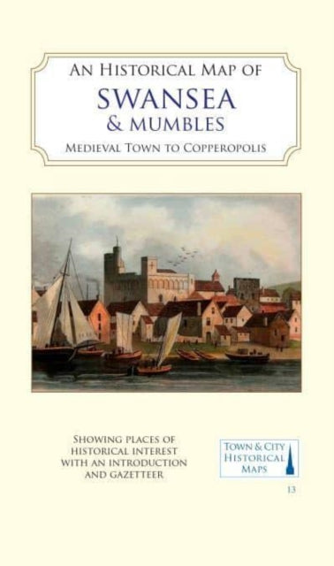
An Historical Map of Swansea & Mumbles: medieval town to Copperopolis
An Historical Map of Swansea & Mumbles: medieval town to Copperopolis
💎 Earn 40 Points (£0.40) on this item.
YOU SAVE £2.95
- Condition: Brand new
- UK Delivery times: Usually arrives within 2 - 3 working days
- UK Shipping: Fee starts at £2.39. Subject to product weight & dimension
Bulk ordering. Want 15 or more copies? Get a personalised quote and bigger discounts. Learn more about bulk orders.
Couldn't load pickup availability
- More about An Historical Map of Swansea & Mumbles: medieval town to Copperopolis
A full colour map of Swansea, based on digitised OS maps of 1919, shows its medieval past overlaid with important buildings. The map includes an inset map of Mumbles and its medieval castle. Swansea became a centre for trade in the Middle Ages, with Swansea Castle established in the early 12th century. In the 17th century, copper-smelting became the main industry, making Swansea the world capital of the copper industry. Heavy industry and spoil heaps dominated the lower Tawe valley, but evidence of its medieval past and street layout survived.
Format: Sheet map, folded
Length: 2 pages
Publication date: 03 April 2023
Publisher: The Historic Towns Trust
A full-colour map, based on digitized OS maps of Swansea from around 1919, showcases the city's medieval past overlaid with important buildings highlighted. The map includes an inset map of Mumbles and its medieval castle. During the Middle Ages, Swansea (Abertawe) thrived as a trade hub near the mouth of the river Tawe. Following Norman control, Swansea Castle was established in the early 12th century, and a borough charter was granted at the end of that century. In the 17th century, the area experienced significant growth with the establishment of copper-smelting in the lower Tawe valley. Swansea took advantage of its local coal resources and excellent port facilities to process copper, arsenic, tin, gold, and other metals, utilizing imported raw materials from around the world. The port exported the final products, along with substantial amounts of coal. At the time of the background map depicted here, heavy industry and its waste heaps dominated the lower Tawe valley, while extensive docks dominated the south of the town. However, remnants of the city's medieval past and its street layout remained. The remains of the Norman castle were repurposed as a workhouse, and the course of the river Tawe was altered to facilitate easier access for ships.
Dimension: 206 x 127 (mm)
ISBN-13: 9781838071929
This item can be found in:
UK and International shipping information
UK and International shipping information
UK Delivery and returns information:
- Delivery within 2 - 3 days when ordering in the UK.
- Shipping fee for UK customers from £2.39. Fully tracked shipping service available.
- Returns policy: Return within 30 days of receipt for full refund.
International deliveries:
Shulph Ink now ships to Australia, Belgium, Canada, France, Germany, Ireland, Italy, India, Luxembourg Saudi Arabia, Singapore, Spain, Netherlands, New Zealand, United Arab Emirates, United States of America.
- Delivery times: within 5 - 10 days for international orders.
- Shipping fee: charges vary for overseas orders. Only tracked services are available for most international orders. Some countries have untracked shipping options.
- Customs charges: If ordering to addresses outside the United Kingdom, you may or may not incur additional customs and duties fees during local delivery.