David Brawn
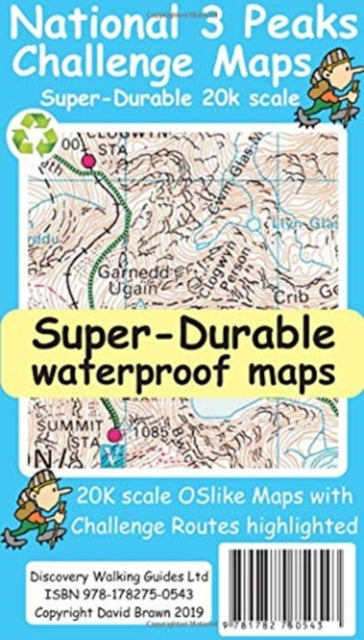
National 3 Peaks Challenge Maps
National 3 Peaks Challenge Maps
💎 Earn 32 Points (£0.32) on this item.
YOU SAVE £2.58
- Condition: Brand new
- UK Delivery times: Usually arrives within 2 - 3 working days
- UK Shipping: Fee starts at £2.39. Subject to product weight & dimension
Bulk ordering. Want 15 or more copies? Get a personalised quote and bigger discounts. Learn more about bulk orders.
Couldn't load pickup availability
- More about National 3 Peaks Challenge Maps
National 3 Peaks Challenge Maps are waterproof, tearproof, and 100% recyclable, with expanded mapping at 50k scale and added Challenge Routes. Each peak is a 420mm by 420mm OS-like map mounted on a double-sided map sheet, printed on a 100 micron plastic substrate with UV-cured inks.
Format: Sheet map
Length: 2 pages
Publication date: 01 January 2019
Publisher: Discovery Walking Guides Ltd
The National 3 Peaks Challenge Maps are a comprehensive set of maps designed specifically for participants in the challenging 3 Peaks mountain trek. These maps encompass the three peaks of Ben Nevis, Scafell Pike, and Snowdon, each presented at a scale of 20,000.
The mapping process begins with the utilization of Ordnance Survey (OS) mapping at a scale of 50,000. By expanding the coverage of the OS map, the details of names, roads, tracks, and trails are significantly increased in size, making them more readable and easily discernible even under challenging conditions.
To enhance the usability of the maps, the Challenge Routes are specially highlighted to stand out against the OS map background information. Additionally, additional information is provided to aid participants in their journey, including details about access roads, walking routes, and starting points.
Each map covers the entire region, providing clear visibility of the access roads as well as the designated walking routes for each peak. For instance, Ben Nevis includes the Glen Nevis Information Centre and Glen Nevis Youth Hostel as starting points, while Scafell Pike features the Wasdale and Seathwaite Challenge Routes. Snowdon boasts the Pyg Track, Miners Track, and Llamberis Challenge Routes.
The maps are printed on a 100-micron plastic substrate using UV-cured inks on the UK's only press capable of employing this advanced technology. The result is a lightweight map that is both waterproof and tearproof, making it highly durable and capable of withstanding the rigors of the 3 Peaks Challenge. Moreover, the maps are fully recyclable, ensuring a sustainable approach to outdoor recreation.
In conclusion, the National 3 Peaks Challenge Maps are an essential tool for anyone embarking on this challenging trek. With their expanded scale, detailed information, and innovative printing technology, these maps provide participants with the confidence and guidance they need to conquer the three peaks and enjoy a memorable adventure.
Weight: 48g
Dimension: 123 x 211 x 5 (mm)
ISBN-13: 9781782750543
This item can be found in:
UK and International shipping information
UK and International shipping information
UK Delivery and returns information:
- Delivery within 2 - 3 days when ordering in the UK.
- Shipping fee for UK customers from £2.39. Fully tracked shipping service available.
- Returns policy: Return within 30 days of receipt for full refund.
International deliveries:
Shulph Ink now ships to Australia, Belgium, Canada, France, Germany, Ireland, Italy, India, Luxembourg Saudi Arabia, Singapore, Spain, Netherlands, New Zealand, United Arab Emirates, United States of America.
- Delivery times: within 5 - 10 days for international orders.
- Shipping fee: charges vary for overseas orders. Only tracked services are available for most international orders. Some countries have untracked shipping options.
- Customs charges: If ordering to addresses outside the United Kingdom, you may or may not incur additional customs and duties fees during local delivery.