Peter Knowles
Paddling Map of Britain - Third Edition 2022
Paddling Map of Britain - Third Edition 2022
💎 Earn 43 Points (£0.43) on this item.
YOU SAVE £2.26
- Condition: Brand new
- UK Delivery times: Usually arrives within 2 - 3 working days
- UK Shipping: Fee starts at £2.39. Subject to product weight & dimension
Bulk ordering. Want 15 or more copies? Get a personalised quote and bigger discounts. Learn more about bulk orders.
Couldn't load pickup availability
- More about Paddling Map of Britain - Third Edition 2022
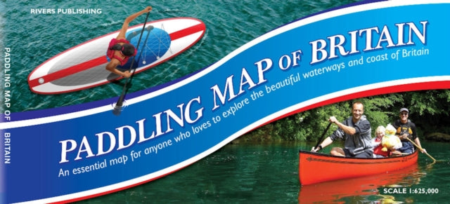
This map provides a comprehensive overview of paddling possibilities on rivers, lochs, canals, and coastlines in mainland Britain, covering 37,000km of waterways. It is color-coded to show the nature of the waterways and includes information on popular paddling trips, white water centers, and locations for selected loch and coastal trips. It is designed to help enthusiasts plan and explore the world of paddling for canoes, kayaks, and SUPs.
Format: Sheet map
Publication date: 18 July 2022
Publisher: Rivers Publishing UK
This comprehensive map of mainland Britain presents a staggering array of paddling opportunities, spanning a vast distance of 37,000 kilometers across rivers, lochs, canals, and the coast. Enthusiasts and newcomers alike find it an invaluable resource for planning and dreaming their paddling adventures. The map is color-coded to provide clear information about the nature of these waterways, with Southern England and Wales on one side and Scotland and the North of England on the reverse. The base map is a detailed depiction of Britain at a scale of 1:625,000, showing roads, towns, villages, rivers, streams, and lakes in pastel colors. Brighter colors indicate 540 rivers graded by difficulty, as well as canals and waterways used by motorized craft. Popular paddling trips, white water centers, and locations for selected loch and coastal trips are highlighted on the map. Information panels provide guidance, recommended websites, and guidebooks, all designed to unlock the world of paddling for canoes, kayaks, and SUPs. Whether you're a seasoned paddler or a novice looking to explore the waters of Britain, this map is a must-have tool for your outdoor adventures.
Dimension: 707 x 1000 (mm)
ISBN-13: 9780995751347
This item can be found in:
UK and International shipping information
UK and International shipping information
UK Delivery and returns information:
- Delivery within 2 - 3 days when ordering in the UK.
- Shipping fee for UK customers from £2.39. Fully tracked shipping service available.
- Returns policy: Return within 30 days of receipt for full refund.
International deliveries:
Shulph Ink now ships to Australia, Belgium, Canada, France, Germany, Ireland, Italy, India, Luxembourg Saudi Arabia, Singapore, Spain, Netherlands, New Zealand, United Arab Emirates, United States of America.
- Delivery times: within 5 - 10 days for international orders.
- Shipping fee: charges vary for overseas orders. Only tracked services are available for most international orders. Some countries have untracked shipping options.
- Customs charges: If ordering to addresses outside the United Kingdom, you may or may not incur additional customs and duties fees during local delivery.