Philip's Maps
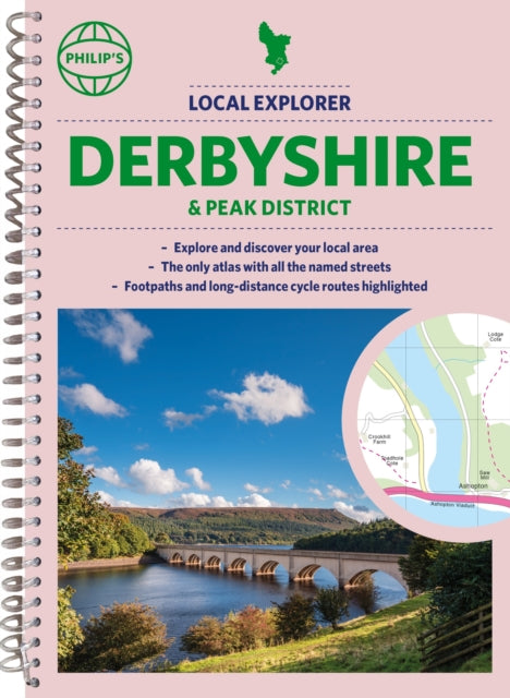
Philip's Local Explorer Street Atlas Derbyshire and the Peak District
Philip's Local Explorer Street Atlas Derbyshire and the Peak District
💎 Earn 62 Points (£0.62) on this item.
YOU SAVE £4.56
- Condition: Brand new
- UK Delivery times: Usually arrives within 2 - 3 working days
- UK Shipping: Fee starts at £2.39. Subject to product weight & dimension
Bulk ordering. Want 15 or more copies? Get a personalised quote and bigger discounts. Learn more about bulk orders.
Couldn't load pickup availability
- More about Philip's Local Explorer Street Atlas Derbyshire and the Peak District
This new series of atlases from Philip's provides detailed mapping and information for walkers, cyclists, and local explorers to uncover nature and hidden gems in their local area. With clear routes and information on A and B roads, it is the only atlas with every road, street, and lane in the county named.
Format: Spiral bound
Length: 328 pages
Publication date: 05 October 2023
Publisher: Octopus Publishing Group
Who hasn't explored and enjoyed their surrounding area in recent years and come to appreciate what is on our respective doorsteps? Philip's have created this new series for walkers, cyclists and local explorers at a scale that provides greener options to uncover all the nature and hidden gems in your local area.
Includes all the streets in BUXTON, CHESTERFIELD, DERBY, LONG EATON, MATLOCK, SWADLINCOTE, Alfreton, Ashbourne, Bakewell, Belper, Bolsover, Brimington, Chapel-en-le-Frith, Clay Cross, Clowne, Dronfield, Eckington, Glossop, Heanor, Ilkeston, New Mills, Pinxton, Ripley, Shirebrook, South Normanton, Staveley, Whaley Bridge, Wirksworth.
The detailed scale allows explorers, walkers and cyclists to avoid main roads and select pathways, bridleways and lanes for optimum enjoyment. Whether it's meandering through the local parks or historic houses, exploring neighbourhood nature spots or the local town, we have the clear mapping and information you need.
If you do have to travel to reach areas you'd like to explore, all A and B roads are clearly shown on our Route Planner and we include all the large-scale town and city plans. Exceptional detail allows the user to pinpoint exactly where they need to go and the best route to follow.
· The only atlas with every road, street and lane in the county named, along with the best pedestrian routes, long-distance cycle routes.
· Highlighting lanes, alleyways, footpaths and bridleways, camping and caravan sites, golf courses, parks, gardens and many, many other places of interest.
· Contains all the usual one-way streets, barriers, car parks, railway and bus stations, hospitals, colleges and schools, police and fire stations, places of worship, post offices, shopping and leisure centres.
Weight: 704g
Dimension: 200 x 271 x 24 (mm)
ISBN-13: 9781849076388
This item can be found in:
UK and International shipping information
UK and International shipping information
UK Delivery and returns information:
- Delivery within 2 - 3 days when ordering in the UK.
- Shipping fee for UK customers from £2.39. Fully tracked shipping service available.
- Returns policy: Return within 30 days of receipt for full refund.
International deliveries:
Shulph Ink now ships to Australia, Belgium, Canada, France, Germany, Ireland, Italy, India, Luxembourg Saudi Arabia, Singapore, Spain, Netherlands, New Zealand, United Arab Emirates, United States of America.
- Delivery times: within 5 - 10 days for international orders.
- Shipping fee: charges vary for overseas orders. Only tracked services are available for most international orders. Some countries have untracked shipping options.
- Customs charges: If ordering to addresses outside the United Kingdom, you may or may not incur additional customs and duties fees during local delivery.