Philip's Maps
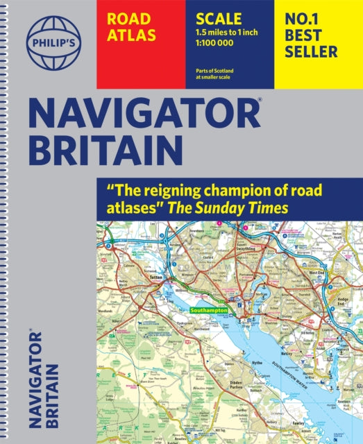
Philip's Navigator Britain: Spiral
Philip's Navigator Britain: Spiral
💎 Earn 98 Points (£0.98) on this item.
YOU SAVE £7.24
- Condition: Brand new
- UK Delivery times: Usually arrives within 2 - 3 working days
- UK Shipping: Fee starts at £2.39. Subject to product weight & dimension
Bulk ordering. Want 15 or more copies? Get a personalised quote and bigger discounts. Learn more about bulk orders.
Couldn't load pickup availability
- More about Philip's Navigator Britain: Spiral
Navigator Road Atlases from Philip's - the UK's best-selling road atlases. With more detail and information than any other atlas and large-scale mapping that makes driving easy in both towns and the countryside.
Format: Spiral bound
Length: 412 pages
Publication date: 06 October 2022
Publisher: Octopus Publishing Group
Philip's Navigator: Britain's Best-Selling Detailed Road Atlases
Philip's Navigator is a renowned series of detailed road atlases published in the United Kingdom, known for their exceptional scale, clarity, and accuracy. These atlases have become the go-to choice for motorists seeking comprehensive and reliable mapping information.
One of the standout features of Philip's Navigator is its scale. The maps provide a remarkable level of detail, with a scale ranging from 1.5 miles to 1 inch, depending on the region. This scale allows for incredibly accurate representation of roads, streets, and landmarks, ensuring that drivers have a clear understanding of their surroundings.
In addition to its scale, Philip's Navigator is renowned for its accuracy. The maps are meticulously researched and compiled by experienced cartographers, who work closely with local authorities and road networks to ensure that the information is up-to-date and reliable. This attention to detail ensures that drivers can confidently navigate through Britain's complex road system, without encountering any unexpected surprises or disruptions.
Another key aspect of Philip's Navigator is its clarity. The maps are designed to be easy to read and understand, with clear and legible typography and well-defined road markings. This clarity makes it easier for drivers to locate their destinations, plan routes, and make informed decisions on the road.
One of the standout features of Philip's Navigator is its comprehensive coverage. The atlases include detailed maps of every street in Britain, along with over 3,000 roads clearly named. This extensive coverage ensures that drivers can find their way to any location, whether it's a remote village or a bustling city center.
In addition to street maps, Philip's Navigator also features major National Trails and routes, such as the Hadrian Wall's Path, Offa's Dyke Path, Pennine Way, South Downs Way, Thames Path, The Ridgeway, West Highland Way, and Southern Upland Way. These trails provide opportunities for outdoor enthusiasts and adventurers to explore some of the most stunning landscapes in the United Kingdom.
Furthermore, Philip's Navigator includes 100 indexed town-center maps, along with approaches maps to 12 major urban areas. These maps provide detailed information about local landmarks, attractions, and services, making it easier for drivers to plan their trips and find their way around town.
What sets Philip's Navigator apart from other road atlases is its exceptional road detail. The maps include every junction, roundabout, and slip-road shown, providing drivers with a complete picture of the road network. This level of detail is particularly useful for professional drivers and those who frequently travel on unfamiliar roads.
Another advantage of Philip's Navigator is its spiral paperback binding. This binding allows for easy page turning and convenient access to the maps, making it a practical tool for drivers on the go. The atlases are also durable and long-lasting, ensuring that they can withstand the rigors of regular use.
Philip's Navigator is widely used by professional drivers and the emergency services, including national police training. The atlases are recommended in the motoring press and national newspapers, as they provide the level of detail and clarity that serious motorists require.
In conclusion, Philip's Navigator is a series of detailed road atlases that have become the gold standard in the United Kingdom. With their exceptional scale, accuracy, and clarity, these atlases provide drivers with the confidence and information they need to navigate through Britain's complex road system. Whether you're a professional driver or a casual motorist, Philip's Navigator is the ultimate choice for reliable and comprehensive mapping information.
Weight: 1982g
Dimension: 301 x 359 x 29 (mm)
ISBN-13: 9781849076135
This item can be found in:
UK and International shipping information
UK and International shipping information
UK Delivery and returns information:
- Delivery within 2 - 3 days when ordering in the UK.
- Shipping fee for UK customers from £2.39. Fully tracked shipping service available.
- Returns policy: Return within 30 days of receipt for full refund.
International deliveries:
Shulph Ink now ships to Australia, Belgium, Canada, France, Germany, Ireland, Italy, India, Luxembourg Saudi Arabia, Singapore, Spain, Netherlands, New Zealand, United Arab Emirates, United States of America.
- Delivery times: within 5 - 10 days for international orders.
- Shipping fee: charges vary for overseas orders. Only tracked services are available for most international orders. Some countries have untracked shipping options.
- Customs charges: If ordering to addresses outside the United Kingdom, you may or may not incur additional customs and duties fees during local delivery.