Philip's Maps
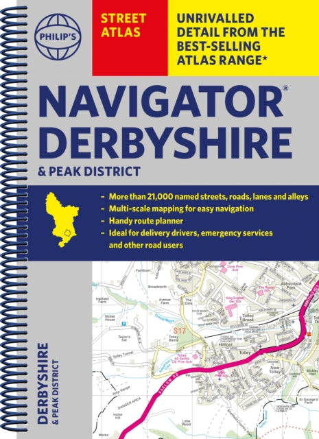
Philip's Navigator Street Atlas Derbyshire and the Peak District
Philip's Navigator Street Atlas Derbyshire and the Peak District
💎 Earn 62 Points (£0.62) on this item.
YOU SAVE £4.56
- Condition: Brand new
- UK Delivery times: Usually arrives within 2 - 3 working days
- UK Shipping: Fee starts at £2.39. Subject to product weight & dimension
Bulk ordering. Want 15 or more copies? Get a personalised quote and bigger discounts. Learn more about bulk orders.
Couldn't load pickup availability
- More about Philip's Navigator Street Atlas Derbyshire and the Peak District
This is the only county street atlas with all the named streets of Derbyshire. It includes 24,000 named streets, roads, lanes, and alleys, as well as practical route-planning sections and super-clear mapping. It is essential for residents and visitors, and also includes postcode boundaries, car parks, railway and bus stations, post offices, schools, colleges, hospitals, police and fire stations, places of worship, leisure centres, footpaths, and bridleways.
Format: Spiral bound
Length: 328 pages
Publication date: 05 October 2023
Publisher: Octopus Publishing Group
The UK's most popular county street atlases
Over 24,000 named streets, roads, lanes, and alleys
The essential map book for residents and visitors - and if you're moving to Derbyshire
Includes all the streets in BUXTON, CHESTERFIELD, DERBY, LONG EATON, MATLOCK, SWADLINCOTE, Alfreton, Ashbourne, Bakewell, Belper, Bolsover, Brimington, Chapel-en-le-Frith, Clay Cross, Clowne, Dronfield, Eckington, Glossop, Heanor, Ilkeston, New Mills, Pinxton, Ripley, Shirebrook, South Normanton, Staveley, Whaley Bridge, Wirksworth
- New edition in practical spiral-bound format
Street maps show car parks, schools, hospitals, and many other places of interest, even ones off the beaten path
- 4-page practical route-planning section showing all A and B roads
- Super-clear mapping
- Easy-to-use index
- Scales: 1¾ inches to 1 mile (1:36,000) and 3½ inches to 1 mile (1:18,000). Major towns: 7 inches to 1 mile (1:9,000).
Other information on the maps includes postcode boundaries, car parks, railway and bus stations, post offices, schools, colleges, hospitals, police and fire stations, places of worship, leisure centres, footpaths and bridleways, camping and caravan sites, golf courses, and many other places of interest.
Weight: 698g
Dimension: 270 x 202 x 23 (mm)
ISBN-13: 9781849076371
This item can be found in:
UK and International shipping information
UK and International shipping information
UK Delivery and returns information:
- Delivery within 2 - 3 days when ordering in the UK.
- Shipping fee for UK customers from £2.39. Fully tracked shipping service available.
- Returns policy: Return within 30 days of receipt for full refund.
International deliveries:
Shulph Ink now ships to Australia, Belgium, Canada, France, Germany, Ireland, Italy, India, Luxembourg Saudi Arabia, Singapore, Spain, Netherlands, New Zealand, United Arab Emirates, United States of America.
- Delivery times: within 5 - 10 days for international orders.
- Shipping fee: charges vary for overseas orders. Only tracked services are available for most international orders. Some countries have untracked shipping options.
- Customs charges: If ordering to addresses outside the United Kingdom, you may or may not incur additional customs and duties fees during local delivery.