Philip's Maps
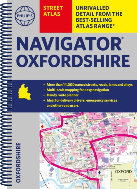
Philip's Navigator Street Atlas Oxfordshire: Spiral edition
Philip's Navigator Street Atlas Oxfordshire: Spiral edition
💎 Earn 62 Points (£0.62) on this item.
YOU SAVE £4.56
- Condition: Brand new
- UK Delivery times: Usually arrives within 2 - 3 working days
- UK Shipping: Fee starts at £2.39. Subject to product weight & dimension
Bulk ordering. Want 15 or more copies? Get a personalised quote and bigger discounts. Learn more about bulk orders.
Couldn't load pickup availability
- More about Philip's Navigator Street Atlas Oxfordshire: Spiral edition
This is the essential map book for residents and visitors to Oxfordshire, with over 11,000 named streets, roads, lanes, and alleys. It includes information on the ZEZ zone and other zones, as well as practical route-planning sections and super-clear mapping.
Format: Spiral bound
Length: 296 pages
Publication date: 06 July 2023
Publisher: Octopus Publishing Group
The ultimate county street atlas for Oxfordshire, a must-have for emergency services, delivery drivers, visitors, and locals alike! With over 11,000 named streets, roads, lanes, and alleys, this comprehensive map book is an essential companion for residents and visitors, especially when time is of the essence.
Covering a vast area, including ABINGDON-ON-THAMES, BANBURY, BICESTER, DIDCOT, HENLEY-ON-THAMES, KIDLINGTON, OXFORD, THAME, WITNEY, Adderbury, Benson, Burford, Carterton, Caversham, Chalgrove, Charlbury, Chinnor, Chipping Norton, Cholsey, Cowley, Cumnor, Eynsham, Faringdon, Goring, Grove, Headington, Highworth, Kennington, Lechlade-on-Thames, Middleton Cheney, Pangbourne, Sonning Common, Stokenchurch, Wallingford, Wantage, Wargrave, Watlington, Wheatley, Woodstock, and Wootton, this atlas provides detailed coverage of the region.
The maps feature a range of useful information, including car parks, schools, hospitals, and numerous other points of interest, even those off the beaten track. Additionally, the atlas includes a 2-page practical route-planning section that showcases all A and B roads, making it easy to plan your journeys.
With its super-clear mapping and easy-to-use index, this atlas is a breeze to navigate. The scales vary from 3½ inches to 1 mile (1:18,000) for Oxford and 7 inches to 1 mile (1:9,000) for other areas, ensuring accurate representation of the terrain.
In addition to street maps, the atlas also includes postcode boundaries, car parks, railway and bus stations, post offices, schools, colleges, hospitals, police and fire stations, places of worship, leisure centres, footpaths and bridleways, camping and caravan sites, golf courses, and many other places of interest. Whether you're a resident or a visitor, this atlas is your go-to resource for all your mapping needs in Oxfordshire.
Weight: 636g
Dimension: 197 x 273 x 19 (mm)
ISBN-13: 9781849076319
This item can be found in:
UK and International shipping information
UK and International shipping information
UK Delivery and returns information:
- Delivery within 2 - 3 days when ordering in the UK.
- Shipping fee for UK customers from £2.39. Fully tracked shipping service available.
- Returns policy: Return within 30 days of receipt for full refund.
International deliveries:
Shulph Ink now ships to Australia, Belgium, Canada, France, Germany, Ireland, Italy, India, Luxembourg Saudi Arabia, Singapore, Spain, Netherlands, New Zealand, United Arab Emirates, United States of America.
- Delivery times: within 5 - 10 days for international orders.
- Shipping fee: charges vary for overseas orders. Only tracked services are available for most international orders. Some countries have untracked shipping options.
- Customs charges: If ordering to addresses outside the United Kingdom, you may or may not incur additional customs and duties fees during local delivery.