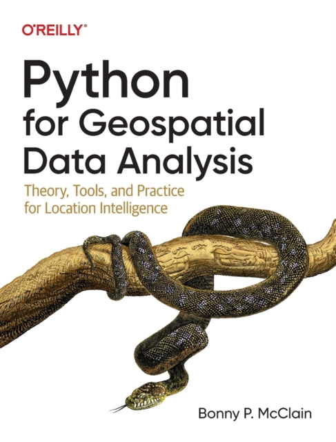
Bonny P. McClain
Python for Geospatial Data Analysis: Theory, Tools, and Practice for Location Intelligence
Python for Geospatial Data Analysis: Theory, Tools, and Practice for Location Intelligence
YOU SAVE £18.31
- Condition: Brand new
- UK Delivery times: Usually arrives within 2 - 3 working days
- UK Shipping: Fee starts at £2.39. Subject to product weight & dimension
Bulk ordering. Want 15 or more copies? Get a personalised quote and bigger discounts. Learn more about bulk orders.
Couldn't load pickup availability
- More about Python for Geospatial Data Analysis: Theory, Tools, and Practice for Location Intelligence
The book "Spatial Data Analysis with Python" teaches geospatial professionals and data scientists how to analyze and visualize spatial data using Python. It covers detecting patterns, data layering, location analytics, map creation, automation, and working with atypical data types.
Format: Paperback / softback
Length: 200 pages
Publication date: 04 November 2022
Publisher: O'Reilly Media
Spatial data science delves into the fascinating realm of understanding the relationships between objects in space. It suggests that objects that are physically close to each other are more likely to share common characteristics than those that are farther apart. This practical guide is designed to empower geospatial professionals, data scientists, business analysts, geographers, geologists, and anyone with a familiarity in data analysis and visualization to delve into the world of spatial data analysis. Author Bonny P. McClain sheds light on the critical importance of detecting and quantifying patterns within geospatial data. Whether you choose proprietary or open-source platforms, this book equips you with the skills to process and visualize spatial information effectively.
This comprehensive guide is tailored for individuals with a background in data analysis or visualization who are eager to explore the realm of geospatial integration with Python. It serves as a valuable resource for those seeking to understand the significance of applying spatial relationships in data science, select and apply data layering techniques for both raster and vector graphics, leverage location data for spatial analytics, design informative and accurate maps, automate geographic data processing with Python scripts, and explore a wide range of Python packages for additional functionality. Moreover, this book delves into working with atypical data types such as polygons, shape files, and projections, ensuring a comprehensive understanding of spatial data science. By grasping the graphical syntax of spatial data science, readers are encouraged to cultivate a sense of curiosity and embark on a journey of discovery.
Weight: 616g
Dimension: 177 x 233 x 25 (mm)
ISBN-13: 9781098104795
This item can be found in:
UK and International shipping information
UK and International shipping information
UK Delivery and returns information:
- Delivery within 2 - 3 days when ordering in the UK.
- Shipping fee for UK customers from £2.39. Fully tracked shipping service available.
- Returns policy: Return within 30 days of receipt for full refund.
International deliveries:
Shulph Ink now ships to Australia, Belgium, Canada, France, Germany, Ireland, Italy, India, Luxembourg Saudi Arabia, Singapore, Spain, Netherlands, New Zealand, United Arab Emirates, United States of America.
- Delivery times: within 5 - 10 days for international orders.
- Shipping fee: charges vary for overseas orders. Only tracked services are available for most international orders. Some countries have untracked shipping options.
- Customs charges: If ordering to addresses outside the United Kingdom, you may or may not incur additional customs and duties fees during local delivery.


