Shulph Ink
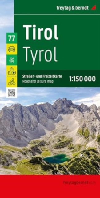
Tyrol: Road and Leisure Map
Tyrol: Road and Leisure Map
💎 Earn 49 Points (£0.49) on this item.
YOU SAVE £2.93
- Condition: Brand new
- UK Delivery times: Usually arrives within 2 - 3 working days
- UK Shipping: Fee starts at £2.39. Subject to product weight & dimension
Bulk ordering. Want 15 or more copies? Get a personalised quote and bigger discounts. Learn more about bulk orders.
Couldn't load pickup availability
- More about Tyrol: Road and Leisure Map
The road and leisure map of Tyrol on a scale of 1:150,000 contains useful information for a trip to the west of Austria, including a complex road and rail network, tourist roads, scenic roads, camping and RV sites, automobile club breakdown services, and top tips for worthwhile excursion destinations. It also highlights popular tourist attractions such as Innsbruck's old town, the Kufstein Fortress, Landeck Castle, the Karwendel Nature Park, the Schwaz silver mine, and the Otzi village of Umhausen.
Format: Sheet map, folded
Length: 1 pages
Publication date: 15 January 2024
Publisher: Freytag-Berndt
The Tyrol road and leisure map, scaled at 1:150,000, is a comprehensive resource for travelers venturing to the western part of Austria. It provides detailed information about the intricate road and rail network, showcasing various regional cycle paths and long-distance cycle routes. Tourist roads and scenic routes are visually highlighted in color, showcasing numerous attractive destinations.
Thanks to freytag & berndt's precise cartography and the ideal scale, this map serves as an excellent tool for planning and orientation purposes. The map offers a wealth of information, including camping and RV sites, automobile club breakdown services, and top tips for worthwhile excursion destinations.
Innsbruck's old town, the Kufstein Fortress, and Landeck Castle are among the popular tourist attractions featured on the map. Nature enthusiasts can explore the Karwendel Nature Park, while families can enjoy entertaining hours at the Schwaz silver mine or the Otzi village of Umhausen.
For those who enjoy traveling by car or motorbike, Tyrol offers a plethora of scenic tourist roads. The Silvretta High Alpine Road, the Sisi Road, and the Zillertaler Hohenstrabe are among the highlights, known for their breathtaking landscapes and stunning views.
Whether you're planning a road trip or exploring the natural beauty of Tyrol, this map is an invaluable resource that will help you navigate your way and make the most of your journey.
Dimension: 1375 x 940 (mm)
ISBN-13: 9783707922400
This item can be found in:
UK and International shipping information
UK and International shipping information
UK Delivery and returns information:
- Delivery within 2 - 3 days when ordering in the UK.
- Shipping fee for UK customers from £2.39. Fully tracked shipping service available.
- Returns policy: Return within 30 days of receipt for full refund.
International deliveries:
Shulph Ink now ships to Australia, Belgium, Canada, France, Germany, Ireland, Italy, India, Luxembourg Saudi Arabia, Singapore, Spain, Netherlands, New Zealand, United Arab Emirates, United States of America.
- Delivery times: within 5 - 10 days for international orders.
- Shipping fee: charges vary for overseas orders. Only tracked services are available for most international orders. Some countries have untracked shipping options.
- Customs charges: If ordering to addresses outside the United Kingdom, you may or may not incur additional customs and duties fees during local delivery.