Collins Maps
Wild Atlantic Way Pocket Map: The Perfect Way to Explore Ireland's West Coast
Wild Atlantic Way Pocket Map: The Perfect Way to Explore Ireland's West Coast
💎 Earn 14 Points (£0.14) on this item.
YOU SAVE £1.15
- Condition: Brand new
- UK Delivery times: Usually arrives within 2 - 3 working days
- UK Shipping: Fee starts at £2.39. Subject to product weight & dimension
Bulk ordering. Want 15 or more copies? Get a personalised quote and bigger discounts. Learn more about bulk orders.
Couldn't load pickup availability
- More about Wild Atlantic Way Pocket Map: The Perfect Way to Explore Ireland's West Coast
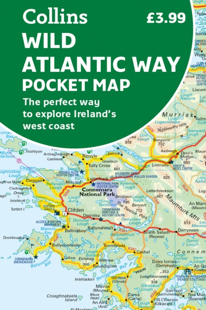
The Collins Handy Pocket Map of Ireland's Wild Atlantic Way is a full-color map with a high level of detail that covers the 2500 km (over 1500 miles) route. It is ideal for tourists, locals, hikers, and adventurers, with clear mapping, detailed place names index, and suggested itineraries. It is also an excellent companion to a sat-nav for route planning and route sense-checking.
Format: Sheet map, folded
Publication date: 02 March 2023
Publisher: HarperCollins Publishers
Explore new places with handy pocket maps from Collins.
Handy full-colour map of Ireland's Wild Atlantic Way with a high level of detail.
Clear mapping of the full 2500 km (over 1500 miles) route, showing the road network and places of interest.
Clear, detailed Collins road mapping is presented in a handy format ideal for the pocket or handbag.
It is excellent value and very detailed for its size, covering the whole of the Wild Atlantic Way.
Ideal for tourists, locals, hikers, and adventurers.
Places of interest marked, including famous film locations.
This map includes:
Clear mapping at a scale of 8.7 miles to 1 inch
National Tourist Routes showing best routes through the most scenic areas
Places of interest include film locations such as Star Wars
Tourist and signature locations clearly marked
Suggested itineraries
Detailed place names index
Ideal companion to a sat-nav – it enables route planning and route sense-checking
Weight: 42g
Dimension: 90 x 142 x 10 (mm)
ISBN-13: 9780008580001
Edition number: 2 Revised edition
This item can be found in:
UK and International shipping information
UK and International shipping information
UK Delivery and returns information:
- Delivery within 2 - 3 days when ordering in the UK.
- Shipping fee for UK customers from £2.39. Fully tracked shipping service available.
- Returns policy: Return within 30 days of receipt for full refund.
International deliveries:
Shulph Ink now ships to Australia, Belgium, Canada, France, Germany, Ireland, Italy, India, Luxembourg Saudi Arabia, Singapore, Spain, Netherlands, New Zealand, United Arab Emirates, United States of America.
- Delivery times: within 5 - 10 days for international orders.
- Shipping fee: charges vary for overseas orders. Only tracked services are available for most international orders. Some countries have untracked shipping options.
- Customs charges: If ordering to addresses outside the United Kingdom, you may or may not incur additional customs and duties fees during local delivery.